At the close of the last Ice Age, a landmass larger than India stitched Southeast Asia together. Then the sea took it.
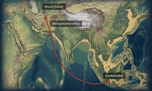
Around 11,700 years ago, post-glacial flooding drowned the vast Sunda Shelf in a series of catastrophic events echoed across the world's "great flood" traditions. Our central question is a bold one: was Sundaland a flourishing maritime culture whose survivors carried knowledge outward — seeding agriculture, astronomy and language into the settlements that later became Mesopotamia and Egypt?
The Sundalandia Discovery Project exists to test that hypothesis with rigorous, multidisciplinary science — geology, marine bathymetry, paleoclimatology and human migration studies — and to bring the evidence to the surface.
~11,700
years ago · the drowning
1.8M km²
shelf submerged
−90m
anomaly depth
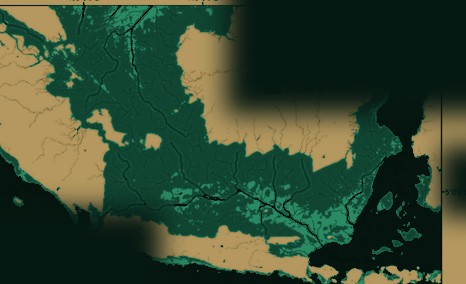
Exposed land · Last Ice AgeNow seabed · −120m
~20,000 years ago. Sea levels sat ~120m lower. The exposed Sunda Shelf joined Sumatra, Borneo and Java into one landmass — larger than modern India.
The Vision · 01:19−25M
See the world we're diving for
A ninety-second descent into the mystery, the evidence, and the mission ahead.
The Evidence−40M
A case built across three disciplines
No single reading proves a lost world. Converging lines of evidence make it a question science can no longer ignore.
Geological · The Site
The Sangiang Anomaly
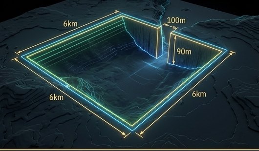
6 KM BASIN · 90 M DEPTH
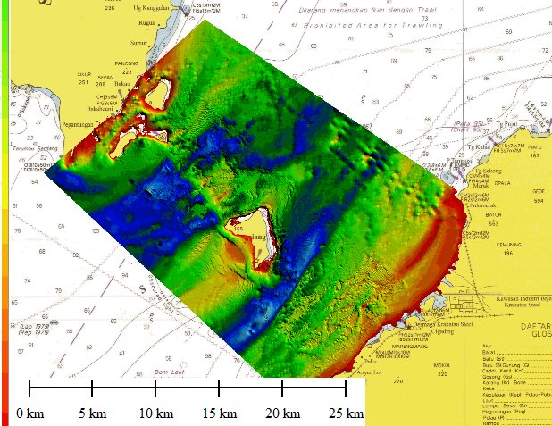
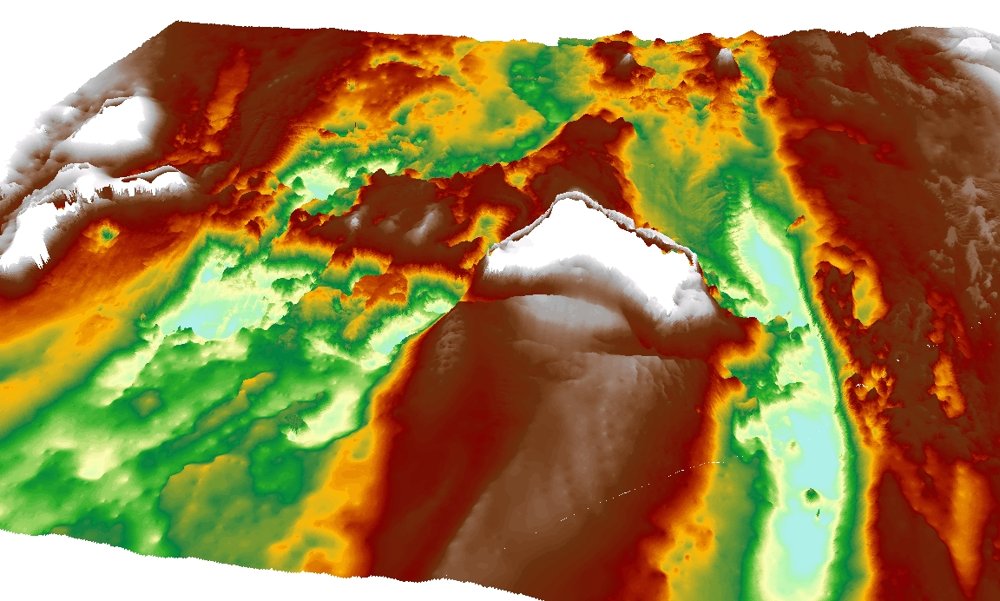
High-resolution multibeam bathymetry near Sangiang Island has mapped a striking rectilinear feature — a near-perfect square basin flanked by wall-like structures. Its geometry is difficult to explain by natural processes alone, and researchers believe it warrants direct investigation.
Paleoclimatology · The Event
The Younger Dryas
~11,700 YEARS AGO
The abrupt climate reversal at the end of the last Ice Age drove rapid sea-level rise that submerged the Sunda Shelf. The timing aligns with "great flood" accounts recorded independently by cultures across the ancient world.
Anthropological · The Migration
Eden in the East
OPPENHEIMER · OXFORD
Prof. Stephen Oppenheimer's research traces threads of language, myth and technology outward from Southeast Asia. It offers a framework for how a displaced Sundaland population could have influenced the rise of later civilizations.
Anomaly reconstruction · 6 km basinMultibeam survey · plan view3D bathymetric relief
Phase I · Bathymetric Survey
The scan that started it all
Phase I multibeam mapping of the Sunda Strait produced the first detailed picture of the seafloor around Sangiang — the plan-view survey and 3D relief shown here. This is the target Phase II goes back to film.
Precedent close to home: the megalithic site of Gunung Padang in West Java has drawn international attention for evidence of great antiquity — a reminder that Indonesia's deep past may be far older than the textbooks assume.
The Expedition−70M
From sonar to seafloor
A phased mission that moves from remote mapping to human hands on ancient stone — broadcast to the world.
Phase IComplete
The Survey
Multibeam bathymetric mapping of the Sunda Strait has located and characterised the Sangiang anomaly, establishing the target and the scientific case for going deeper.
Phase IISeeking funding
ROV Deployment
Deep-sea remotely operated vehicles descend to −90m to capture the first high-resolution footage of the structure, documenting its scale, surfaces and geometry.
Phase IIISeeking funding
Live Dives & Recovery
Technical divers and scientists conduct in-person expeditions to survey the site and recover artifacts — culminating in a live global broadcast of the discovery.
DEPTH −90M · SUBMERGED MONOLITHIC GATEWAY
Ninety metres down, colossal carved pillars may still stand.
If the anomaly is what the data suggests, it is a testament to engineering that predates every monument we thought came first. There is only one way to know for certain — to go there.